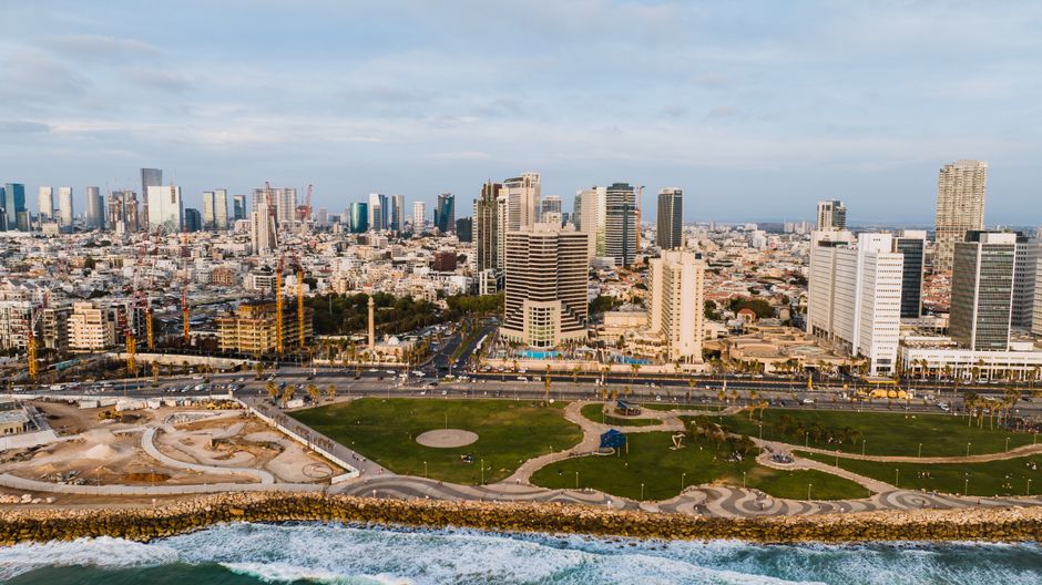
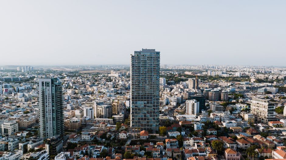
Tel Aviv's municipal planning and building authority is confronting a practical but consequential problem: its central digital archive of building facade photographs, used by inspectors, developers and residents filing renovation permits across the city, contains a significant volume of duplicate images that are muddying records for hundreds of properties. The issue, which has accumulated over at least four years of digitisation work, now sits at the top of the agenda for the Authority for Building Permits and Inspections, which operates out of Ibn Gabirol Street and processes thousands of applications annually.
The timing matters. Tel Aviv is midway through its 2025–2030 master plan cycle, a period in which the municipality has committed to accelerating approvals for urban renewal projects — particularly TAMA 38 earthquake-reinforcement schemes and Pinui-Binui demolition-and-rebuild initiatives across neighbourhoods from Florentin to Neve Tzedek. Inaccurate or duplicated visual records attached to the wrong cadastral parcels can delay permit approvals by weeks and, in contested cases, expose the city to legal challenge by neighbouring property owners.
What the Problem Actually Looks Like on the Ground
In practical terms, a duplicate image in the archive means that a facade photograph taken at, say, a building on Dizengoff Street gets attached — either through a scanning error or a metadata mismatch — to a separate property record, sometimes streets away in the Lev Ha'ir central district. Planning inspectors reviewing an application then see visual documentation that does not match the structure in front of them. The Merkaz Maarav district office on Shlomo Ibn Gabirol, which handles permit traffic for the northern seafront corridor, flagged the discrepancy problem internally after a cluster of TAMA 38 submissions in late 2025 arrived with mismatched supporting images.
The Tel Aviv-Yafo Municipality's digital infrastructure directorate has been running a phased GIS integration project since 2023, designed to link the building registry to a unified mapping layer. That project, budgeted at approximately 12 million shekels across three years, included a commitment to standardise image metadata. But the duplicate problem predates the GIS work and was not fully accounted for in the project's original scope, according to documents reviewed by The Daily Tel Aviv.
Three Decisions That Will Shape the Fix
Engineers and planners now face three interlocking choices. First, the municipality must decide whether to run an automated deduplication algorithm across the entire archive — a faster solution, but one that risks deleting images incorrectly flagged as duplicates — or to commission a manual audit of the roughly 4,200 property records estimated to carry suspect images. The manual route is slower and more expensive, with external GIS consultants pricing the work at between 800 and 1,200 shekels per property record.
Second, the authority must determine which records take priority. Properties in active permit review — there are currently around 340 TAMA 38 applications in various stages across the city — would logically come first. But older records tied to heritage-listed buildings in the White City UNESCO zone, centred on Rothschild Boulevard and the surrounding Bauhaus streets, carry their own legal sensitivity and arguably need equal attention.
Third, and most structurally significant, city planners must decide whether the archive's image ingestion workflow needs to be rebuilt from scratch or whether new validation rules layered onto the existing system will be sufficient. A source familiar with the project described the current ingestion process as one that lacks an automatic uniqueness check at the point of upload — meaning duplicates can enter the system without triggering any alert.
The municipality has not publicly announced a decision date, but internal scheduling documents suggest the building authority expects to bring a recommendation to the relevant municipal committee before the end of September 2026. Whatever path is chosen, permit applicants in high-density corridors like the HaYarkon Street seafront and the Sarona business district should anticipate the possibility of additional documentation requests while the archive is under review. Property owners with active renovation plans would be well advised to contact the Ibn Gabirol permit office directly to confirm whether their building's file is among those flagged for correction.